
On a laptop or smartphone screen, a parent enters their home address into a municipal web portal or neighborhood safety app. Within seconds, a high-resolution interactive street map populates the display. Color-coded pins drop onto local blocks, each marking the registered address of an individual convicted of a sexual offense. A quick tap on a pin reveals a profile: a mugshot, full name, physical description, offense category, and exact distance from the user’s front door.
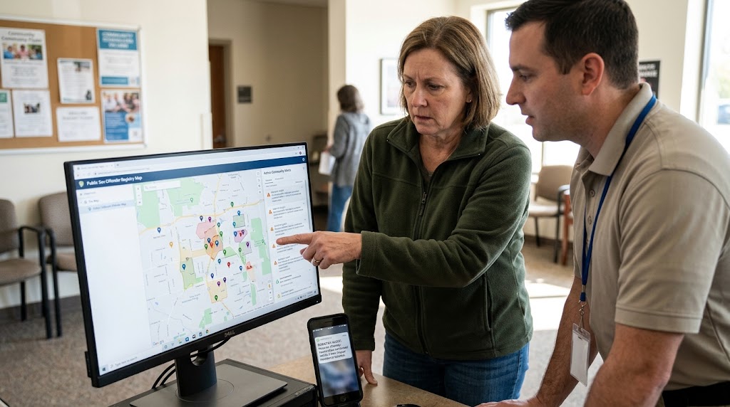
Over the past three decades, public safety infrastructure has undergone a profound digital transformation. What began in the late 20th century as physical paper files bound in municipal police department cabinets has evolved into sophisticated, real-time spatial databases accessible to anyone with an internet connection. Driven by Geographic Information Systems (GIS), automated geocoding algorithms, and real-time alert networks, public sex offender registries represent one of the most visible intersections of law enforcement data and daily civic life.
Yet despite their widespread availability, the complex technical mechanics, statutory frameworks, and operational limitations that govern these digital registries are rarely understood by the public. How does raw police intake data transform into an automated push notification? How do algorithms calculate exclusion zones? And what does scientific research say about the effectiveness of public mapping tools?
The Legal Architecture: Mandates for Public Exposure
To understand how registry mapping tools function today, one must first understand the legal statutes that compelled their creation. In the United States, sex offender registration transitioned from an internal police intelligence tool to a public broadcast system through a series of federal and state legislative actions.
The foundation was laid by the Jacob Wetterling Crimes Against Children and Sexually Violent Offender Registration Act of 1994, which conditioned federal law enforcement funding on states establishing registries. Two years later, following the rape and murder of seven-year-old Megan Kanka by a neighbor with prior sexual offense convictions, Congress passed Megan’s Law in 1996. This landmark legislation mandated that law enforcement agencies make relevant registry information available to the general public, establishing the principle of community notification.
In 2006, the Adam Walsh Child Protection and Safety Act overhaul statutory standards by establishing the Sex Offender Registration and Notification Act (SORNA). SORNA established national baseline registration requirements and organized registrants into a three-tiered system based on the offense of conviction:
- Tier I: Typically covers lowest-level offenses; mandates registration for 15 years, with annual in-person address verification.
- Tier II: Covers moderate-severity offenses; mandates registration for 25 years, with semi-annual in-person address verification.
- Tier III: Covers serious, violent, or repeat offenses; mandates lifetime registration, with quarterly in-person address verification.
SORNA also established the federal framework for the National Sex Offender Public Website (NSOPW.gov), managed by the U.S. Department of Justice. NSOPW acts as a national clearinghouse and search engine, linking individual state, territorial, and tribal registry databases into a single query interface.
Internationally, public notification frameworks vary significantly. While the United States maintains a broadly accessible public mapping system, nations such as the United Kingdom, Canada, and Australia handle registry data differently. In the UK, the Violent and Sex Offender Register (ViSOR) is a secure database restricted entirely to law enforcement, social services, and prison officials, though police maintain discretionary authority to disclose information to specific community members if an immediate risk is identified.
From Booking to Database: How Registry Data Is Collected
A sex offender map is only as functional as the underlying data harvested by law enforcement officers. The data creation process begins during criminal sentencing or immediately upon an individual’s release from a correctional facility into community supervision.
By law, individuals subject to registration must report in person to a designated local law enforcement agency—typically a county sheriff’s office or municipal police department. During intake, officers compile a comprehensive record that extends far beyond a basic criminal charge:
- Biometric Data: Fingerprints, palm prints, and updated high-resolution digital photographs (mugshots) capturing current facial features, hair color, and distinguishing marks.
- Physical and Personal Identifiers: Height, weight, eye color, tattoos, scars, aliases, and driver’s license or state identification numbers.
- Geographic and Spatial Identifiers: Primary residential address, secondary addresses (such as temporary lodgings or vacation homes), primary workplace locations, and educational institutions where the registrant is enrolled or employed.
- Vehicular Information: Make, model, color, year, and license plate numbers of all vehicles owned, registered, or regularly operated by the individual.
- Digital Footprints: Under updated provisions of SORNA and state statutes, registrants in many jurisdictions must provide email addresses, instant messaging screen names, and social media account handles.
Once collected, local law enforcement personnel enter these data points into specialized records management software. These local files are automatically transmitted via secure state CJIS (Criminal Justice Information Services) networks to state-level central registries, which subsequently sync with federal databases like the FBI’s National Crime Information Center (NCIC) and the public NSOPW portal.
The Mechanics of Mapping: Geocoding and Buffer Zones
The core engine driving public registry maps is Geographic Information Systems (GIS) technology. GIS transforms raw, textual address strings into precise spatial coordinates that can be analyzed and rendered visually on digital maps.
The Geocoding Process
When an officer enters a street address (for example, “742 Evergreen Terrace”) into a registry software suite, the application routes the text to a geocoding engine. The engine cross-references the address against local GIS datasets—often maintained by county assessors or municipal mapping departments—containing parcel boundaries and street centerlines.
The geocoder converts the address string into latitude and longitude coordinates. Once these spatial coordinates are assigned, the database records the exact geographic point of the residence. This point is what populates as a pin on public-facing mapping applications.
Automated Buffer Zones and Exclusion Rules
Beyond displaying pin locations, GIS technology enforces statutory residency restrictions. Many state legislatures and municipal councils have enacted laws prohibiting registered sex offenders—particularly those whose offenses involved minors—from residing within specified distances of protected locations.
Common protected locations include:
- K-12 public and private schools
- Licensed childcare facilities and daycares
- Public parks, playgrounds, and community swimming pools
- Youth sports complexes and recreation centers
The required buffer distance varies by jurisdiction, typically spanning 500 feet, 1,000 feet, or 2,000 feet.
Advanced registry software—such as OffenderWatch, an enterprise platform utilized by thousands of law enforcement agencies across the United States—integrates spatial buffer modeling directly into the registration workflow. When an officer types a proposed residential address for an offender during an intake interview, the software instantly draws a digital vector polygon (a circular buffer zone) around all cataloged protected sites in the surrounding area.
If the proposed address coordinate falls within a legally prohibited buffer zone, the software issues an automated warning flag to the officer. This real-time spatial check prevents the law enforcement agency from approving an unlawful address before the individual moves in.
How Automated Alert Systems Function
While interactive web maps allow citizens to manually search their surroundings, automated alert systems provide passive, real-time community monitoring. These alerts rely on dynamic background queries that run continually across spatial databases.
Radial Geofencing for Citizens
When a member of the public signs up for registry notifications through a state justice portal, county sheriff’s website, or independent third-party application, they establish a personal geofence.
The user inputs a anchor location—such as their home address, workplace, or their child’s school—and specifies a monitoring radius, typically ranging from 0.25 miles to 5 miles. The system’s geocoder translates the user’s anchor location into latitude and longitude coordinates and stores the search perimeter in a notification database.
Event-Driven Database Triggers
The notification system relies on event-driven database triggers. Whenever one of three events occurs, an automated job is executed:
- New Offender Registration: A newly convicted offender, or an offender relocating from another jurisdiction, registers an address within the database.
- Address Change: An existing registrant updates their primary or secondary address.
- Status Change: A registrant’s legal status changes, such as returning to custody, absconding, or being removed from the registry.
During the event execution, the system calculates the spatial distance between the newly updated offender coordinate and all user-defined geofences stored in the system. If the offender’s coordinate falls within a subscriber’s designated radius, the server automatically generates and dispatches an alert via email, SMS, or mobile push notification.
Interagency Communications
Beyond public notifications, registry platforms manage critical interagency communications. If a registered offender reports an intention to move to a different city, county, or state, the sending agency’s registry software automatically broadcasts an electronic notice to the law enforcement agency in the receiving jurisdiction. This ensures local law enforcement is aware of the incoming registrant before their arrival, allowing officers to initiate background tracking and compliance sweeps.
Technical and Operational Challenges
Despite significant technological advancements, public sex offender mapping systems face several technical, logistical, and structural hurdles that can compromise data accuracy and system reliability.
1. Geocoding Errors and Rural Mapping Failures
Geocoding software relies on structured spatial data. In urban and suburban areas with well-defined street grids and digitized property parcels, geocoding accuracy is high. However, in rural areas—where addresses may involve rural routes, post office boxes, or unmapped dirt roads—geocoders often fail to identify precise building structures.
In such cases, legacy mapping engines may default to placing a pin at the geometric center (centroid) of a postal ZIP code or town boundary. This can falsely display an offender as living in the middle of a intersection, downtown commercial zone, or public park miles from their actual residence.
2. Data Latency and Synchronization Delays
While technology allows for instant data transfer, human processing introduces unavoidable delays. A lag of days or weeks can occur between the moment a registrant moves, the time they report the change to local law enforcement, the manual data entry by departmental staff, and the subsequent data sync between local, state, and federal public portals. During this window of latency, public maps display outdated geographic information.
3. The Unhoused and Transient Population
A major challenge for point-based spatial mapping is the monitoring of unhoused registrants. Under federal guidelines, individuals without permanent shelter must still register. Law enforcement agencies often record these individuals by listing cross-streets, park locations, or shelter addresses.
Because standard GIS mapping relies on fixed property parcels, mapping unhoused registrants requires manual workarounds, such as plotting general intersection pins. These approximations can lead to neighborhood confusion or inaccurate public notifications.
4. Third-Party Data Scraping and Private Apps
Numerous private, commercial mobile applications and third-party websites scrape public registry databases and re-package the data for consumer download. While state-run portals update routinely, commercial third-party applications often fail to sync their databases regularly.
As a result, private apps frequently retain records of individuals who have completed their statutory registration obligations, moved away, or been legally removed from the registry. This creates persistent digital records that can lead to false accusations or public harassment of individuals no longer subject to public monitoring.
The Policy Debate: Public Safety vs. Empirical Efficacy
The proliferation of public mapping tools and real-time alert systems has made sex offender registries a cornerstone of modern community policing. However, criminologists, legal scholars, and policy analysts remain deeply divided regarding their actual impact on public safety.
Arguments Supporting Public Registries
Proponents of public mapping and notification networks argue that transparency is a fundamental public right. Key arguments include:
- Situational Awareness: Public maps allow parents, school administrators, and community leaders to exercise informed caution and adjust supervisory practices based on proximity to registered individuals.
- Enhanced Law Enforcement Oversight: Automated geofencing tools assist law enforcement agencies in managing large registrant caseloads, verifying compliance, and investigating local crimes by instantly identifying registrants living near a crime scene.
- Deterrence: Supporters maintain that public exposure and continuous monitoring deter registered individuals from reoffending due to the high risk of immediate detection.
Empirical Findings and Criticism
Conversely, a substantial body of academic research funded by organizations such as the U.S. National Institute of Justice (NIJ) raises questions about whether public mapping tools reduce crime.
Key criticisms raised by legal experts and criminologists include:
- Negligible Impact on Recidivism: Multiple empirical studies comparing sexual offense reoffending rates before and after the implementation of Megan’s Law have found no statistically significant reduction in recidivism rates attributable to public registries.
- Misconception of Risk Sources: Public registries and spatial maps inherently focus on danger from strangers living in the surrounding neighborhood. However, law enforcement and public health data consistently show that the vast majority of sexual offenses committed against both adults and children are perpetrated by family members, acquaintances, or trusted authority figures—individuals who would not trigger neighborhood stranger alerts.
- The “Banishment” Effect: In densely populated urban areas, overlapping 1,000-foot or 2,000-foot buffer zones around schools, parks, daycares, and bus stops can legally eliminate 80% to 90% of available housing stock. Researchers argue that this spatial restriction forces registrants into homelessness, transient living, or rural isolation. These destabilizing factors increase general stress and economic insecurity, which can counterproductively elevate overall crime risk rather than mitigate it.
- Broad Offense Categories: Critics argue that statutory tier systems often treat widely disparate offenses similarly on public maps. A young adult convicted of non-violent statutory offense between consensual peers may appear on the exact same public map—and under similar color-coded icons—as a violent, predatory offender, diluting the public’s ability to assess actual risk levels.
The Path Forward: Risk-Based Models and Technological Refinement
As mapping technologies continue to advance, policy discussions are gradually shifting toward refining how registry systems collect, process, and display data.
Several legal scholars and law enforcement professionals advocate transitioning away from rigid, offense-based statutory tiers toward individualized actuarial risk assessments. Tools like the STATIC-99R assess specific, validated risk factors to determine an individual’s actual probability of reoffending. Under a risk-based model, public mapping resources and alert notifications would be focused primarily on high-risk individuals, reducing spatial banishment for low-risk individuals while providing the public with more meaningful, actionable safety information.
Concurrently, law enforcement agencies are continually upgrading their underlying GIS infrastructure. The integration of high-resolution parcel data, automated address validation APIs, and direct synchronization between municipal court databases and state registries is reducing instances of geocoding errors and data latency.
Public sex offender registries operate as a complex technological web where legal statutory requirements, spatial mathematics, and public safety priorities meet. By understanding the backend mechanics of geocoding, spatial buffer zones, and automated event triggers, citizens can navigate these public tools with a clearer perspective on both their practical capabilities and technical boundaries.
Leave a Reply